{: it}
Natural disasters and tragedies caused by men have meant that the historic center of Ancona has been, more or less consciously, forgotten by a large part of the city's inhabitants. Only a few people over time have kept the memory of these places alive in some way, including the Cardeto Park.
The war opened large voids in urban space, especially in the Guasco area and surrounding areas. Sometimes we have chosen to leave everything as it was 70 years ago, other times we have chosen to rebuild with questionable results, and a unitary urban planning project has always been missing.
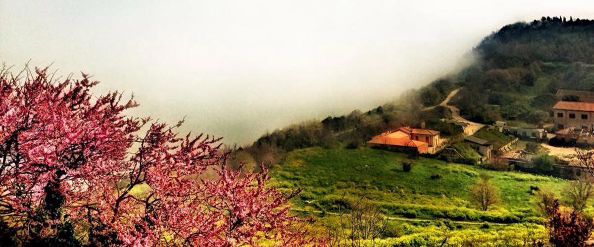
The area that goes from the Guasco hill, with the cathedral of San Ciriaco, the Colle dei Cappuccini and Monte Cardeto and beyond to via Panoramica, has had a positive fate by being subject, in large part, to military servitude . Immediately at the foot of Guasco we find the church of San Sebastiano and San Gregorio Illuminatore. The title of San Gregorio takes us back to the year 1847, when the Armenian Benedictine Nuns entered the church (Saint Gregory the Illuminator is the patron saint of Armenia). But the church had already been linked to the Armenian nation for centuries if in 1570 the Armenian merchant Giorgio Morato commissioned the Madonna with child and saints to the painter Girolamo Siciolante da Sermoneta which found a place in the altar of the church of San Sebastiano and which in 1811 was removed by the French to be taken to Brera from where, given the lack of space, it was placed in the sacristy of the church of Calcinate in the province of Bergamo where it is still found... (this is another sad story that unites many towns in the Marche and Umbria and which we will talk about another time). The Armenian Nuns remained in the church until 1898. Next to the church was the convent, which already began its prison function in 1835. After the earthquake of 1972 and the demolition of the building, excavation work on the Roman amphitheater began. Beyond the depression formed by the Amphitheatre, you go up again, towards the Colle dei Cappuccini. It is from this point that we enter the Cardeto Park area.
The whole area we are talking about is the place where the first human settlements of the city of Ancona took place. In particular, at the foot of the Colle dei Cappuccini, between via dell'Ospizio and via del Faro, there was a proto-Villanovan settlement (1383th-1554th century BC) later occupied by Picene populations. On the top of the hill stood the fortress of San Cataldo, begun by Malatesta and completed by Cardinal Albornoz, which the people of Ancona destroyed in January 25. In 1859 the church and convent of the Capuchins were built in that area (hence the name of Colle), which later became the Stamura Barracks. The Polytechnic University of Marche had shown an interest in the building provided it could be reached by a road, but last November XNUMXth the Municipality of Ancona with a council act gave the go-ahead to the sale of the former barracks by the State, through the company Invimit Sgr. In addition to the Barracks on the Hill, there are two lighthouses: the one currently used and the old lighthouse from XNUMX, near which there are some batteries from the post-unification period. For some years the old lighthouse was kept open by Legambiente, but it has been closed for some time because it needs restoration work.
 The Campo degli Ebrei, the ancient Jewish cemetery, extends between the Colle dei Cappuccini and Monte Cardeto. The first documents relating to the use of this place as a cemetery area for the flourishing Jewish community of Ancona date back to 1428. Originally it bordered the Campo della Mostra, the current Piazza Malatesta, then it was enlarged in 1462 and 1711 until it occupied today's space. The partial arrangement of the area has made it possible to locate, especially in the lower part, numerous tombstones, some of which, the most recent, are in Italian. The nineteenth-century wall that surrounds the cemetery on the side facing the city has been restored and used as a walkway that goes up to the belvedere, close to the door that leads to the lighthouse, in order to allow an overall view of the place. The cemetery area has been reduced by approximately 10 meters compared to the road that goes up close to the sea. In the area close to the wall on the city side, an elm grove has grown over the years and has been maintained as have many of the essences present in the Park area. Inside the Camp, the few gravestones that remained on the edge of the cliff were also relocated, as were the much larger ones (around 70) which, having been ruined by the sea, were recovered and for many years were deposited in an area of the Jewish cemetery. at the Tavernelle. Some barracks present in the vicinity of the Jewish cemetery had been transformed into the so-called Time Deposit, but the lack of care and maintenance caused them to fall back into a state of decay. On the opposite side of these Barracks, the restoration of the Castelfidardo Polveriera has now reached its end, essentially lacking only the furnishings of the room which should have been entrusted with a tender. Also nearby is the former quadruped infirmary of the Villarey barracks which has been restored and is used by the Faculty of Economics of the Univpm of Ancona. The Park area continues towards the eighteenth-century fortifications up to the southern entrance which is located above the former Umberto I hospital. In recent years the population has become aware of the beauty and importance of this place. One of the most fascinating aspects lies precisely in the presence of this important park, both naturalistic, archaeological and historical, within the city. However, there was a lack of continuity in making the city and possible tourists experience all this beauty.

{:} {: en}
Because of natural catastrophes and tragedies caused by men, the old town of Ancona has been – consciously or unconsciously – forgotten by most of the inhabitants of the city. Only a few people over the years have kept the memories of these places alive in some way.
The area that goes from the Guasco hill, with the Cathedral of San Ciriaco, the Colle dei Cappuccini and the Mount Cardeto and beyond to Via Panoramica, has been marked by a positive history, largely, because it was an area subject of military servitudes
Immediately at the foothill of Guasco there's the church of San Sebastiano and Saint Gregory the Illuminator. The title of St. Gregory brings us back to the year 1847, when the Armenian Benedictine Nuns entered the church (St. Gregory the Illuminator is the patron saint of Armenia). The church was bound for centuries to the Armenian nation; in fact in 1570 the Armenian merchant Giorgio Morato commissioned the “Virgin with child and Saints” to the painter Girolamo Siciolante da Sermoneta, whose tomb found place in the altar of the church of San Sebastiano. In 1811 it was removed by the French and brought to Brera where, due to lack of space for his tomb, it was placed in the sacristy of the church of Calcinate in the province of Bergamo, where he still remains… (this is another sad story common to many villages in Le Marche and Umbria, we will talk about it in another post). The Armenian Nuns remained in the church until 1898. On the side of the church is the convent that was also used as prison since 1835. After the earthquake of 1972 and the demolition of the building, the excavations for the Roman amphitheater began. Above the valley of the Amphitheater, you can rise towards the Colle dei Cappuccini. It is from this point that we enter the area named the Park of Cardeto.
The area we are talking about is the area in the city of Ancona where the first human settlements took place. Particularly at the foot of the Colle dei Cappuccini, between Via dell'Ospizio and Via del Faro there was a Protovillanovian settlement (10th and 9th century Before Christ), later occupied by Picene populations. On the top of the hill there was the Fortress of San Cataldo, begun by Malatesta and completed by Cardinal Albornoz, later destroyed by the Anconitans in January 1383. In 1554 the church and convent of the Capuchins (from which the name of the Colle) were built in that area, then later they became the Stamura military base. The Polytechnic University of Le Marche (UNIVPM) showed interest in the building, only if it was provided with a good road, but on Nov., 25 2014 the Municipality of Ancona with a municipal act gave the authorization to sell the former Military Base Stamura by the State, through the brokerage of the company Invimit Sgr. In addition to the Military Base there are two lighthouses upon the Colle: one is currently used, and an old lighthouse dating back to 1859. Close to the old lighthouse there are also artilleries from the post-unitarian period. For some years the old lighthouse was kept open by Legambiente, but lately it has long been closed because it needs restoration work.
Between the Colle dei Cappuccini and Mount Cardeto there's the Campo degli Ebrei, the ancient Jewish cemetery. The first documents related to the destination of this area to a cemetery for the local flourishing Jewish Anconetan community date back to 1428. Its original borders were Campo della Mostra, today's Malatesta Square, then later it was enlarged in 1462 and 1711 to cover today's space . The partial renovation of the area allowed to identify, especially in the lower part, numerous tombstones, including some of the most recent, in Italian language. The nineteenth-century wall, that straddles the cemetery from the side towards the city, was restored and used as a military walkway that rises up to the Belvedere, close to the door that leads to the Lighthouse, so to have a panoramic view of the site. The cemetery area was reduced by about 10 meters from the road that rises close to the sea. A holm grove has grown over the years in the area close to the wall, on the side in front of the city, that has been preserved as well as many of the essences in the Park area. Inside the cemetery were also replaced the few gravestones that remained on the edge of the cliff and the much larger ones (about 70) that, ruined at sea, were recovered and for many years were deposited in an area of the Jewish cemetery at Tavernelle. Some barracks close to the Jewish cemetery were transformed into the so-called Warehouse of Time, but lack of care and maintenance made them fall back into a state of degradation. From the opposite side of these Barracks, the recently restored Polveriera Castelfidardo, which essentially lacks only the furnishing of the hall that undergoes a public tender notice. Nearby is the former quadruped infirmary of the military base Villarey which was restored and is used by the Economics Faculty of the UNIVPM of Ancona. The Park area also covers the eighteenth-century fortifications to the south entrance above the former Umberto I hospital. In these years the population has become aware of the beauty and importance of this place. One of the most fascinating aspects lies in the presence within the city of this important park for its naturalistic, archaeological and historical features. However, there is no continuity in making the citizens and potential tourists enjoy all this beauty.
{:}